- Published on
在 MySql 中使用空间数据类型
MySql 5.7 之后提供了 GIS 数据类型,但是如果想要使用一些地理函数,最好版本还是大于 8.0.
基本操作:
# 查询
SELECT ST_asText(coordinate) as coor from space;
# 插入
UPDATE space SET coordinate = ST_GeomFromText(POINT(34.5002 113.4533));
# 计算距离
SELECT id, name, address, ST_asText(coordinate) as coordinate from acl.space
where ST_Distance_Sphere(
  coordinate,
  ST_GeomFromText('POINT(23.077842362827848 114.39401839894293)', 4326)
) <= 100000;
为列指定 SRID
# GEOMETRY 可以存储任意类型的 spatial 数据.
CREATE TABLE geom (g GEOMETRY NOT NULL SRID 4326);
# 查看制定列的 SRID
SELECT ST_SRID(geometry_column) FROM your_table LIMIT 1;
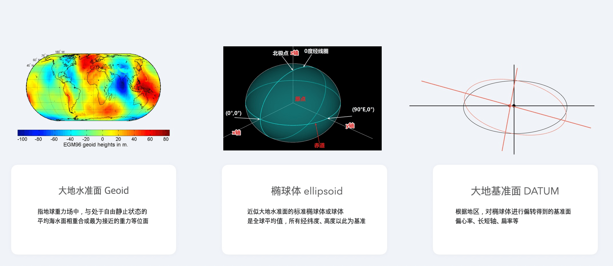
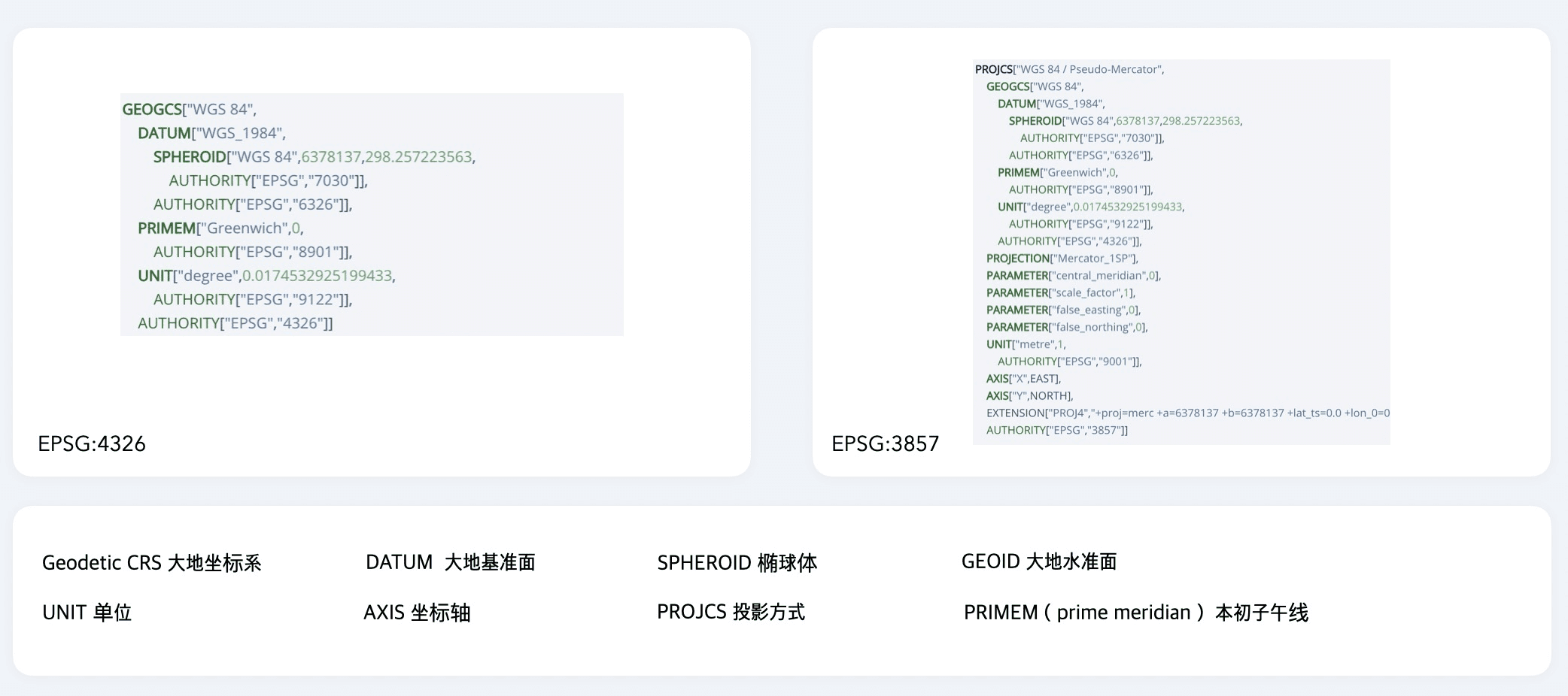
SRID 指定的是 spatial 数据的坐标系。定义了大地水准面,椭球体,大地基准面,经纬度方向等。
MySql 默认的 SRID 为0,表示可以存储任意 SRID 的数据。
常见的 SRID 是 4326,即 84 坐标系。国内其他的高德,火星,百度坐标系都是基于 4236 坐标系,只是做了位置上的偏移。
4326 坐标系的坐标是 lat/lng 顺序。
在 MySql 中,可以修改某列数据的 SRID,前提是已有的坐标数据是合法的待转换的 SRID 数据。注意这并不会改变改 Column 的 SRID,只对已有的数据生效。这时候依然不能在该列上创建空间索引。
-- Update the new column with the transformed geometries
UPDATE your_table SET new_geometry_column = ST_SRID(geometry_column, your_srid);
也可以通过创建新的 Column 来替换。
-- Add a new column with the desired SRID
ALTER TABLE acl.space ADD COLUMN coor1 POINT SRID 4326;

-- copy the values
UPDATE acl.space set coor = coordinate;

-- If you want, you can remove the old column
ALTER TABLE acl.space DROP COLUMN coordinate;

-- And rename the new column to the old one
ALTER TABLE acl.space CHANGE coor1 coordinate POINT SRID 4326 NOT NULL;
创建空间索引
只有在指定了 SRID 的列才能创建空间索引, 并且该列是 NOT NULL.
CREATE SPATIAL INDEX coor ON acl.space (coordinate);
TypeOrm 中使用
@Entity()
export class Space {
  @Column({
    type: 'point',
    comment: '空间坐标',
    srid: 4326,
    transformer: new PointTransformer(),
  })
  @Index({ spatial: true })
  coordinate: string
}